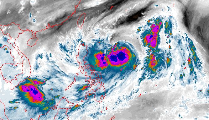
JENNY. Satellite image of Tropical Storm Jenny (Koinu) as of October 1, 2023, 5 am.
NOAA
The maximum sustained winds of Tropical Storm Jenny (Koinu) increase to 85 km/h early Sunday, October 1
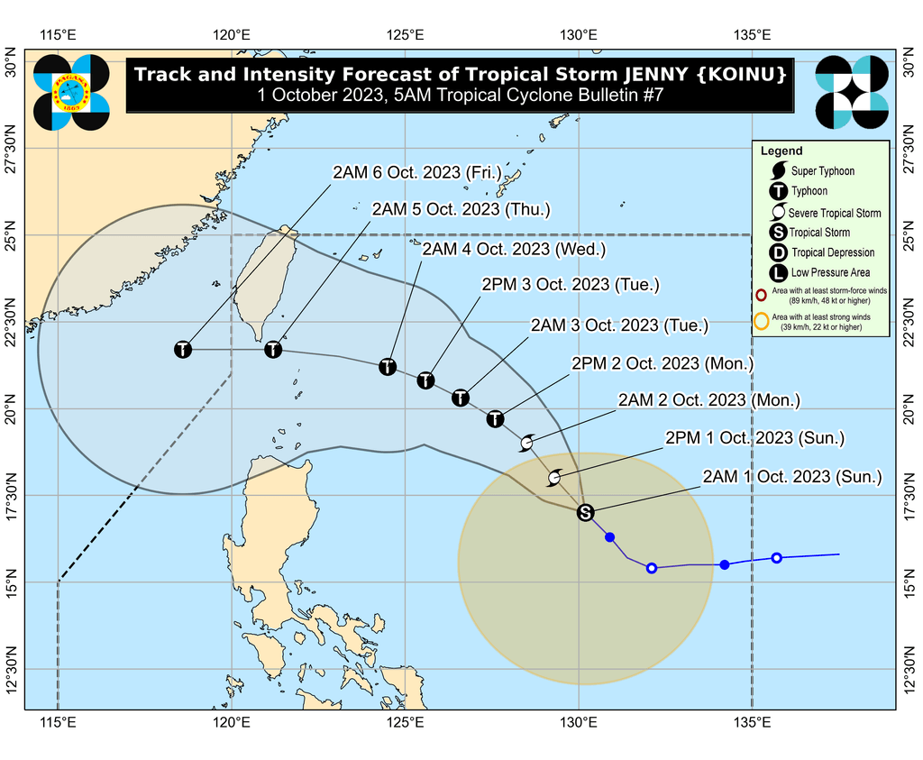
MANILA, Philippines – Tropical Storm Jenny (Koinu) again intensified before dawn on Sunday, October 1, as it continued to move over the Philippine Sea.
The Philippine Atmospheric, Geophysical, and Astronomical Services Administration (PAGASA) said in its 5 am bulletin on Sunday that Jenny already has maximum sustained winds of 85 kilometers per hour from the previous 75 km/h.
The tropical storm’s gustiness is now up to 105 km/h from 90 km/h.
It is expected to strengthen into a severe tropical storm on Sunday and into a typhoon on Monday, October 2.
Jenny was last spotted 835 kilometers east of Central Luzon as of 4 am on Sunday, moving northwest at a slightly faster 20 km/h from 15 km/h.
PAGASA sees Jenny maintaining its northwest direction until Monday before turning west northwest toward the Luzon Strait on Tuesday, October 3, and west on Wednesday, October 4.
It is still projected to pass over the Bashi Channel between Batanes and the southern part of Taiwan between Wednesday evening and Thursday morning, October 5. Taiwan is within the Philippine Area of Responsibility (PAR).
“However, a landfall or close approach scenario over extreme Northern Luzon is still not ruled out,” PAGASA said.
Jenny remains too far to directly affect the country, but its trough or extension is causing scattered rain showers and thunderstorms in Isabela, Aurora, Quezon, and Bicol on Sunday.
PAGASA said Jenny could start bringing heavy rain to Batanes, Babuyan Islands, and the northern parts of mainland Cagayan, Apayao, and Ilocos Norte on Wednesday or Thursday.
Tropical cyclone wind signals may also be raised for extreme Northern Luzon starting Sunday evening or Monday, or even earlier, to inform affected areas to prepare for severe winds from Jenny.
ALSO ON RAPPLER
Jenny is also likely to enhance the southwest monsoon or habagat. PAGASA earlier warned the following areas to watch out for rain from the southwest monsoon:
Sunday night, October 1, to Monday night, October 2
Monday night, October 2, to Tuesday night, October 3
The southwest monsoon will also trigger gusty conditions in these areas:
Sunday, October 1, to Monday, October 2
Tuesday, October 3
For coastal waters, moderate to rough seas are expected in extreme Northern Luzon and the northern part of mainland Cagayan on Monday due to Jenny. PAGASA advised small vessels to take precautionary measures or avoid sailing altogether since waves could be 2 to 4 meters high.
The weather bureau added that there is a “high possibility” of a gale warning being issued in the coming days.
Jenny is the Philippines’ 10th tropical cyclone for 2023 and the second for September, having developed last Friday, September 29.
PAGASA expects four to seven tropical cyclones to form within or enter PAR from October 2023 to March 2024. For October alone, there may be two or three tropical cyclones. – Rappler.com